 Full loop
Guides
Language
EnglishCurrency
US dollar · $Your currency applies on GetYourGuide too.
Guide · On foot
The Uluru base walk, from sunrise to 11 am
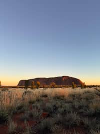
The Uluru base walk circles the whole rock on flat track, past caves, waterholes and woodland. Start early, walk clockwise and finish before the heat, and it is the closest you will come to the rock.
Check availabilityfrom $147 · free cancellation
Editorial team, ulurusunrise.comUpdated October 22, 2026about 6 min to read47 sources
A loop around the whole rock
The base walk is about 10 km of track that takes you around the whole circumference of the rock, and you can walk all of it or only the sections that fit your time, fitness and the weather.5 Parks Australia's own figures are 10.6 km and 3 hours 30 minutes for the loop, graded 3, with drinking water, toilets and emergency call devices along the way.1 For Anangu the walk is more than a hike: the tracks around the base follow the paths of the ancestral beings.6
Each section feels different. Some stretches are green and shaded, good for spotting birds and bush food plants; others are open and exposed, with little shade at all. The track passes acacia woodland and grassed claypans, bloodwood trees, native grasses, waterways and waterholes.7
Because the loop is flat, the challenge is distance and heat rather than climbing. Uluru itself has a circumference of 9.4 km, a little less than the track that circles it.8 Where it does pull away, on the north-east face, there is a reason, which we come to below.
A morning on foot
Round the rock, clockwise
Start at the Mala carpark, walk clockwise
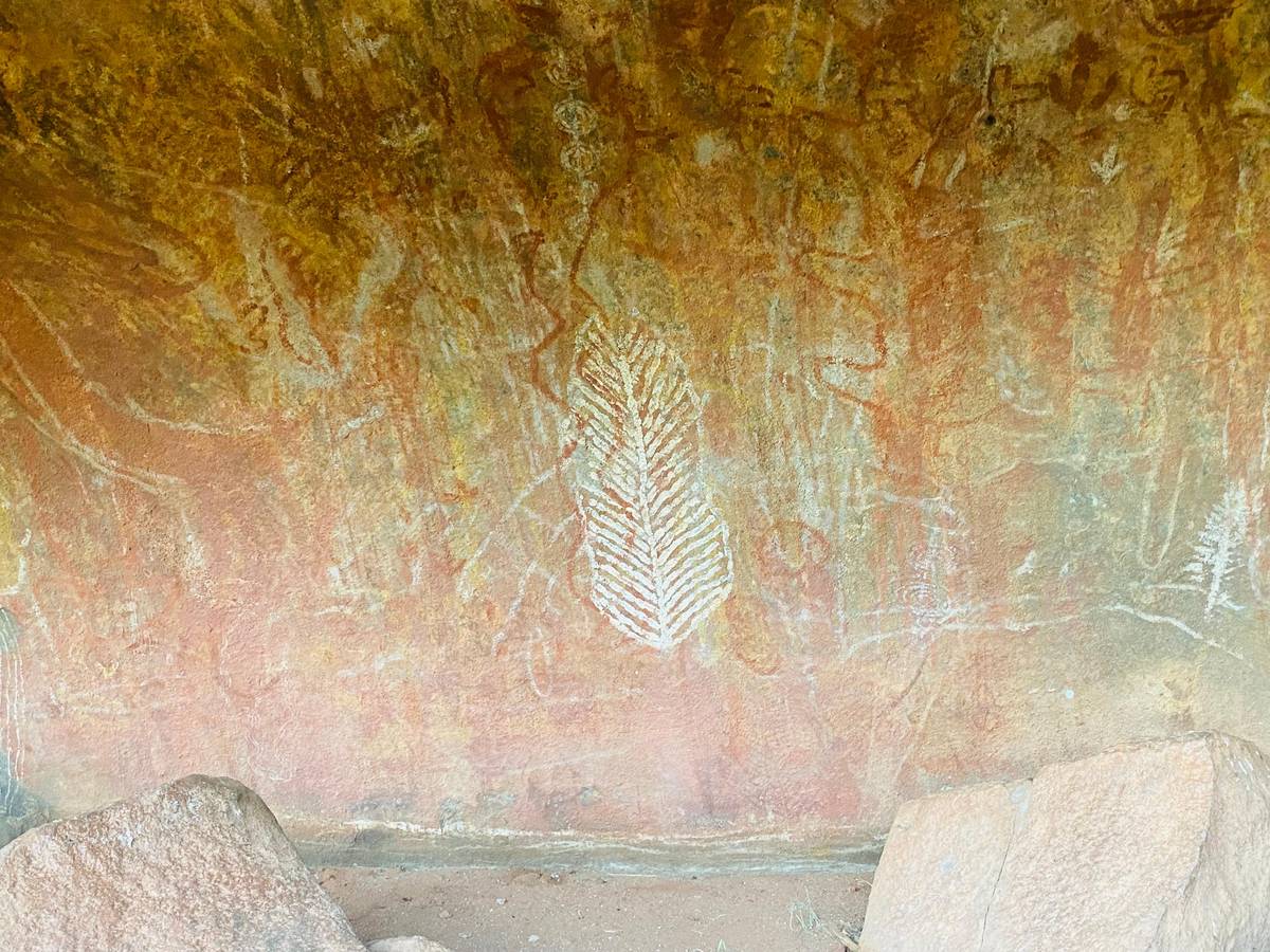
Parks Australia recommends starting from the Mala carpark in the early morning while it is cool, and going clockwise once you face the rock.2 The first section is the Mala walk to Kantju Gorge, the same path used by the daily ranger walk and by most tours of Uluru; it is 2 km return, graded 2, with water and toilets.1516 Rock art can be seen in shelters along it, and you should admire it without ever touching it.17
If you want a guide without paying for one, join the ranger-guided Mala walk. It is free, it meets at the Mala walk carpark and takes 1 hour 30 minutes, starting at 8.00 am from October to April and at 10.00 am from May to September.4 Rangers stop to explain rock art, show traditional Anangu tools and tell the Tjukurpa of the rock formations along the way.18
Timing matters on this stretch. The Mala walk is often busy with guided tours in the mid-morning and late afternoon, so starting your loop soon after sunrise puts you ahead of them.19 The free ranger walk is worth planning around if you can; you can always continue around the rock once it ends.
Section by section
The loop, clockwise from the Mala carpark
| Section | Distance | Time | Grade | Heat closure |
|---|---|---|---|---|
| Mala walk | 2 km return | 1 hr 30 min | 2 | None listed |
| North-east face | 4.4 km one way | 1 hr 45 min | 3 | From 11 am at 40 °C |
| Kuniya side | 1 km return | 30 to 45 min | 2 | None listed |
| Lungkata | 4 km return | 1 hr 30 min | 3 | From 2 pm at 40 °C |
| Whole loop | 10.6 km | 3 hrs 30 min | 3 | Finish by 11 am when hot |
Distances, times, grades and closures from Parks Australia's walk pages.16101214120213
With a guide
Three guided ways around the base
Full loop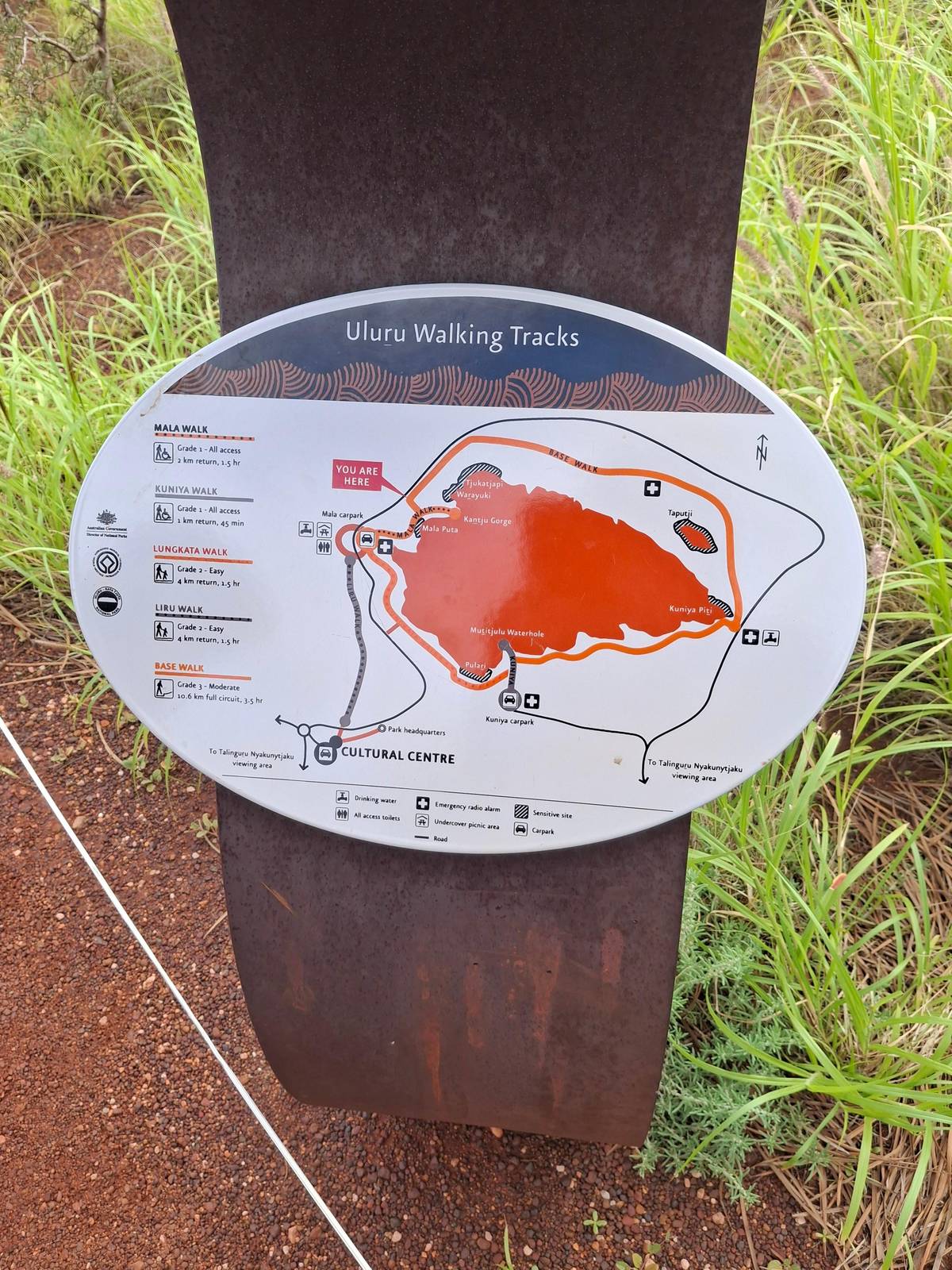 From dawn
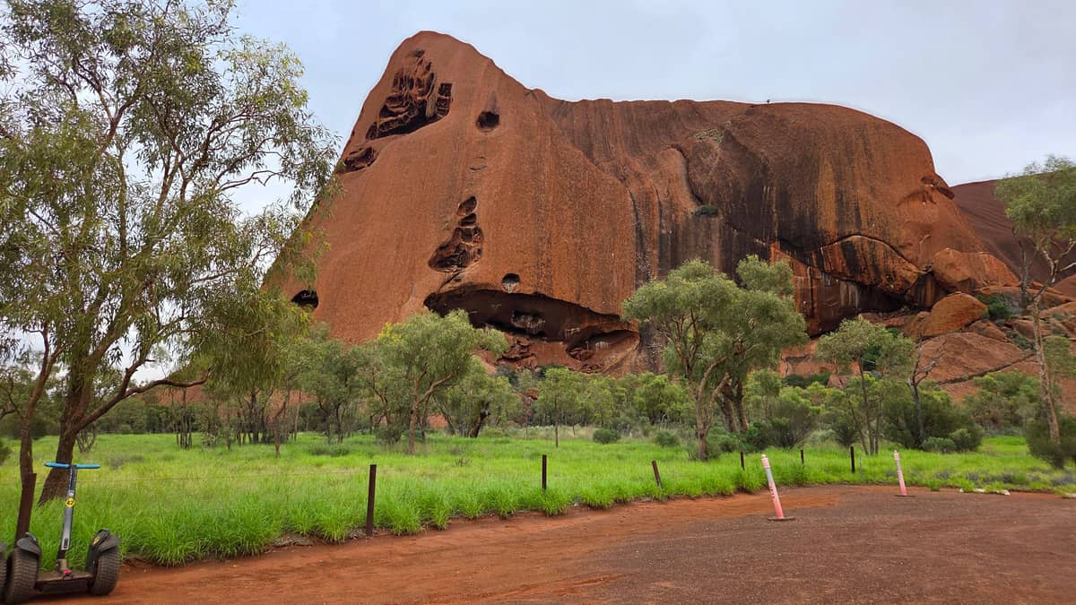 Less walking
Decision helper
How much of the loop?
Match the walk to your morning
Walks around the base of Uluṟu follow the tracks of the ancestral beings.
The north-east face: the long, quiet stretch
From Kitchen Cave on the Mala walk to Kuniya Piti, the track crosses the north-east face, the longest open stretch of the base walk, and keeps its distance from the rock.22 It is 4.4 km one way and takes about 1 hour 45 minutes, graded 3, with water and an emergency call device but no toilets.10 This is where the walk is most exposed to sun and wind.
It is also the part of the rock with the strictest request. The north-east face holds sacred sites, and Anangu ask that you simply enjoy the scenery here and do not take any photographs.9 Put the camera away for the hour and simply look; there are parts of Uluru that you can only see in person.
Heat closes this section first. The North-east walk closes for the day from 11 am when the forecast or actual temperature reaches 40 °C or more.20 On a summer morning, that is the strongest reason to be at the Mala carpark early rather than late.
Map
From Yulara to the sunrise platform, the rock and the domes
The park from the resort to Kata Tjuta, the walks around the base of Uluru, and the car parks among the domes.
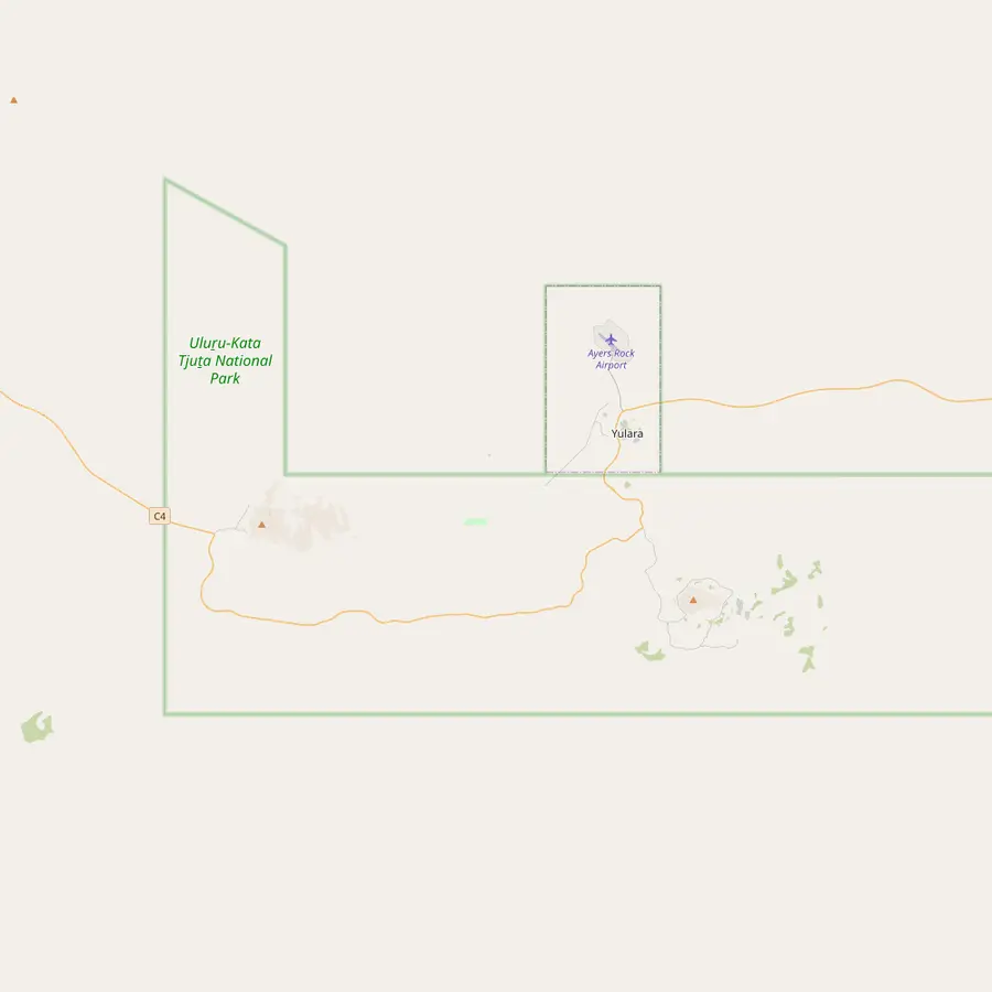 1Yulara (Ayers Rock Resort)2Ayers Rock Airport3Talinguru Nyakunytjaku4Mala carpark5Cultural Centre9Kata Tjuta dune viewing area10Walpa Gorge carpark
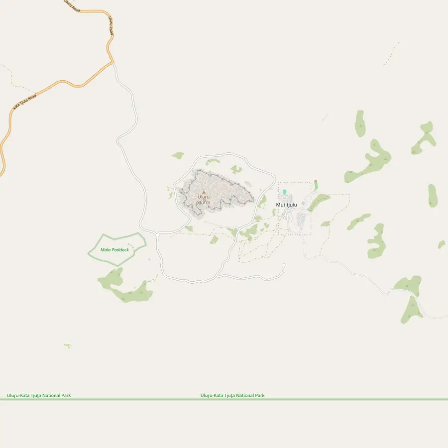 3Talinguru Nyakunytjaku4Mala carpark6Liru walk7Lungkata walk8Kuniya carpark5Cultural Centre
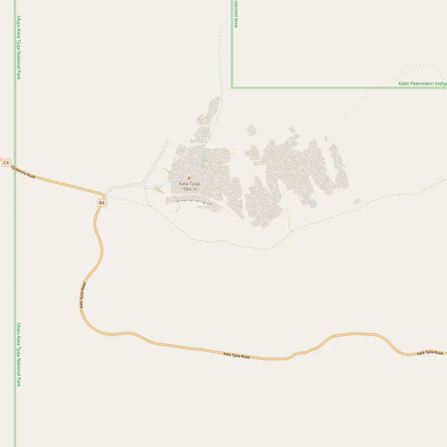 10Walpa Gorge carpark11Valley of the Winds carpark9Kata Tjuta dune viewing area12Kata Tjuta sunset viewing area
- 1Yulara (Ayers Rock Resort)
Where the booked tour picks you up and drops you off; 30 minutes by car from the sunrise area.23
In Google Maps ↗ - 2Ayers Rock Airport
10 minutes from Ayers Rock Resort; on the booked tour, plan flights after 1:00 PM, or 1:30 PM in June and July.23
In Google Maps ↗ - 3Talinguru Nyakunytjaku
The main sunrise viewing area for Uluru, with platforms, shelters, water and toilets.2425
In Google Maps ↗ - 4Mala carpark
Start of the Mala walk and the free ranger-guided walk, and the suggested start of the base walk.1542
In Google Maps ↗ - 5Cultural Centre
Open 7.00 am to 5.45 pm every day; allow at least two hours.2627
In Google Maps ↗ - 6Liru walk
4 km return through mulga forest between the Cultural Centre and the rock.2829
In Google Maps ↗ - 7Lungkata walk
4 km return beside the rock; closes from 2 pm on days of 40 °C or more.1421
In Google Maps ↗ - 8Kuniya carpark
1 km return to one of the few permanent water sources around Uluru.1211
In Google Maps ↗ - 9Kata Tjuta dune viewing area
Kata Tjuta with Uluru on the horizon; busy at sunrise, quiet at sunset.30
In Google Maps ↗ - 10Walpa Gorge carpark
Start of the 2.6 km Walpa Gorge walk, about 1 hour return.31
In Google Maps ↗ - 11Valley of the Winds carpark
Start of the Valley of the Winds walks: Karu lookout 2.2 km return, the full loop 7.4 km.3233
In Google Maps ↗ - 12Kata Tjuta sunset viewing area
Many visitors gather here at the end of the day, leaving Walpa Gorge quiet.34
In Google Maps ↗
Checklist
For the loop on foot
01
Bring
- One litre of water per person per hour
- Broad-brimmed hat and sunscreen
- Sturdy walking shoes
- A fly head net in summer
02
Remember
- Finish before 11 am on hot days3
- No photos of the north-east face
- Stay on the marked track
Cost calculator
A guided loop for your group
Starting totals by group size for guided ways around the rock.
People
Total from$349
per traveler from $175
Check availabilityfree cancellationGroup totals for dawn: the smallest per-person GetYourGuide fare for each tour, multiplied by the number of travelers and converted with the day's euro rate; the booking page shows the exact sum.
Video
Uluru base walk: day walks of the Red Centre
The player loads on your tap, not before.
The Kuniya side and the waterhole
On the southern side of the rock, the short Kuniya walk runs from its own carpark to a permanent waterhole, through a lush and shady area where you may see wallabies in the tall grass and river red gums.35 It is 1 km return and takes 30 to 45 minutes, graded 2, with an emergency call device but no toilets.12 Bush foods grow along it, including tjantu, bush tomatoes, and ili, figs.36
This is the setting of one of Uluru's most important creation stories, the battle between Kuniya, the woma python woman, and Liru, the venomous snake man; the caves Kuniya protects are still used by Anangu.37 Parks Australia asks that Tjukurpa stories are not retold elsewhere, so we leave the telling to the signs along the track, where you can read it in place.3839
A couple of practical notes. The waterhole is busy for much of the day but often quiet at sunrise, sunset and lunchtime, and if you have already watched the sunrise from afar, the carpark here is where you see the sun peek out from behind the south-eastern side of the rock.40 The rock art cave on this side, Kulpi Mutitjulu, was closed after damage; Parks Australia's page gives at least mid-2026 for the reopening, so ask at the Cultural Centre whether it is open again.41
Lungkata and back to the start
The last section, the Lungkata walk, links the Kuniya side with the Mala carpark and is one of the most geologically impressive and visually varied parts of the loop.13 It is 4 km return, graded 3, and takes about 1 hour 30 minutes.14
Its heat rule is a little gentler than the north-east face. The Lungkata walk closes for the day from 2 pm when the forecast or actual temperature reaches 40 °C or more.21 In practice, if you walked clockwise from an early start, you reach this section in the late morning, still well inside its window.
The Liru walk is separate. It links the Cultural Centre with the base of the rock through mulga forest, 4 km return and about 1 hour 30 minutes, and is not part of the loop.282942 It is a good way to start from the Cultural Centre on a cool day and join the base walk on foot.
Heat, water and safety
Temperatures in the park regularly reach 30 °C or more and can pass 40 °C in summer.43 Parks Australia advises walking only in the cooler parts of the day, avoiding 2.30 pm to 6.30 pm, and in summer not walking after 11.00 am; some tracks close in the afternoon in summer because of the risk of heat stroke.433 Carry and drink at least one litre of water per person per hour.44
The numbers at the Yulara weather station explain the advice: average highs are 38.4 °C in January and 36.4 °C in December, but 20.2 °C in June.45 A full loop is a pleasant morning in winter and a serious undertaking in summer, when an early start is not optional.
In an emergency call 000, or 112 from a mobile, and use the emergency radios that stand on most walks.46 After heavy rain, waterfalls run down the rock, and the easiest places to see them close up are the waterhole on the Kuniya side and Kantju Gorge on the Mala walk.47
Walking it with a guide
If you would rather not navigate, a small-group guided trek covers the base over 6 hours, with about 10.5 km on foot and at most 11 participants; its listing asks for a hat, sunscreen, water and warmer clothing in the cooler months. It is rated 4.78 from 246 reviews and starts from $175, with free cancellation until 3 days before.
A guided walk that begins with the sunrise lasts 5.5 hours, leaves 1 hour before sunrise and includes a light breakfast; it asks for moderate fitness and at least 2 liters of water, and is not wheelchair accessible. It starts from $147.
The coach tour this site books does not walk the base: after its sunrise at Talinguru Nyakunytjaku it continues to Kata Tjuta for the Walpa Gorge walk. You can combine the two on different days, one morning with the domes and one on foot around the rock.
Pick your dawn
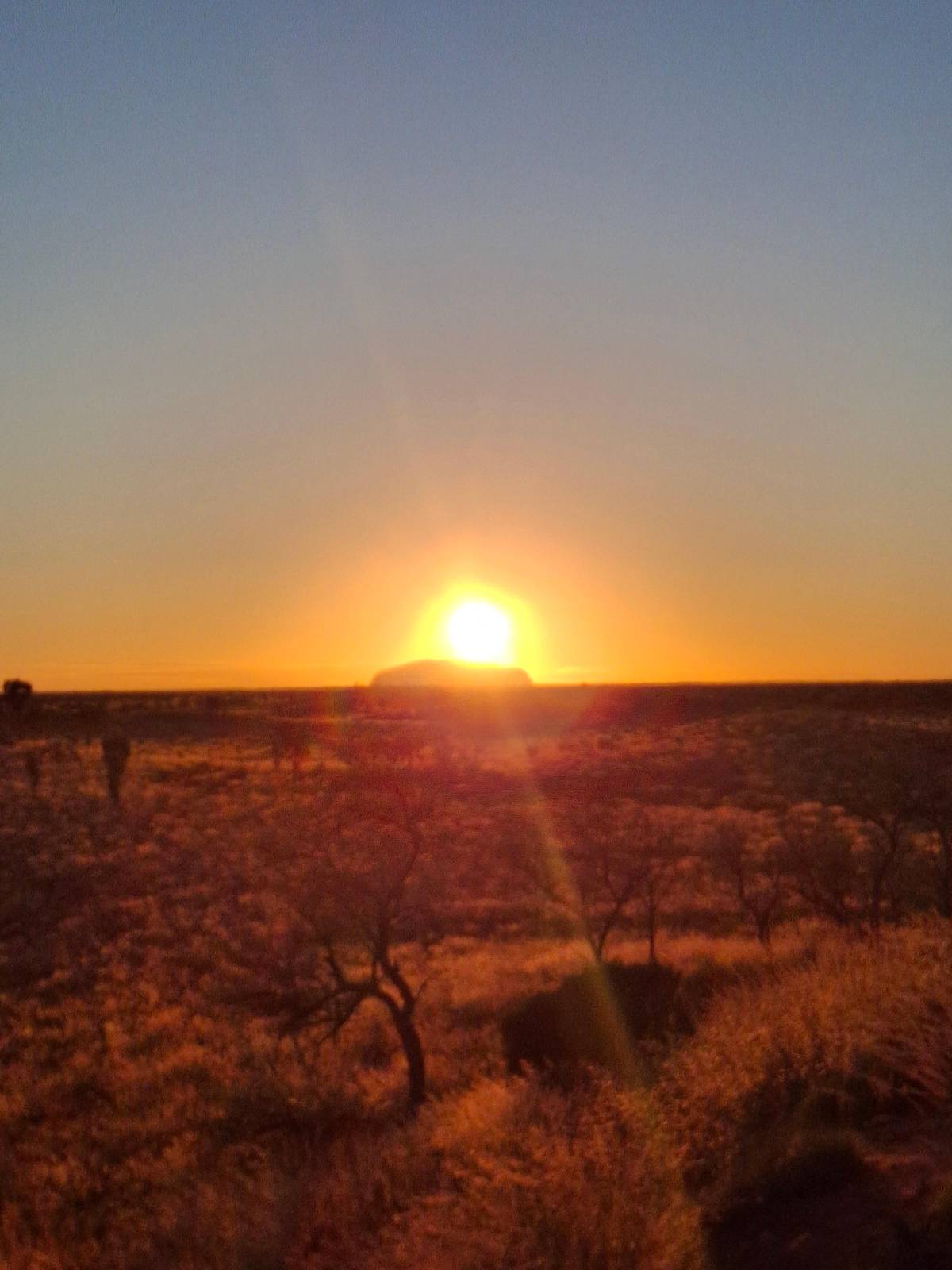
Uluru at first light, Kata Tjuta by mid-morning
Pickup in Yulara, tea or coffee at sunrise and a walk in Walpa Gorge; cancel free up to a day before.


You ask,we answer.
How long is the walk around the rock?
10.6 km. About 3 hours 30 minutes as a loop, graded 3.1
Where should I start?
At the Mala carpark. Early in the morning, walking clockwise.2
Is there water on the way?
Yes. Drinking water and toilets on the loop, but none on some sections.110
Can I photograph the north-east face?
No. Anangu ask that you take no photographs there.9
When does the Mutitjulu Waterhole stay quiet?
Sunrise, sunset and lunchtime. It is busy for much of the day otherwise.40
Is there a free guided walk?
Yes, the ranger Mala walk. 1 hour 30 minutes, at 8.00 am or 10.00 am by season.4
Sources
What this guide is based on
- 1Parks Australia, Uluru-Kata Tjuta National ParkUluru base walk↩
- 2Parks Australia, Uluru-Kata Tjuta National ParkUluru base walk↩
- 3Parks Australia, Uluru-Kata Tjuta National ParkUluru base walk↩
- 4Parks Australia, Uluru-Kata Tjuta National ParkRanger-guided Mala walk↩
- 5Parks Australia, Uluru-Kata Tjuta National ParkUluru base walk↩
- 6Parks Australia, Uluru-Kata Tjuta National ParkWalks↩
- 7Parks Australia, Uluru-Kata Tjuta National ParkUluru base walk↩
- 8Parks Australia, Uluru-Kata Tjuta National ParkUluru↩
- 9Parks Australia, Uluru-Kata Tjuta National ParkNorth-east walk↩
- 10Parks Australia, Uluru-Kata Tjuta National ParkNorth-east walk↩
- 11Parks Australia, Uluru-Kata Tjuta National ParkKuniya walk and Mutitjulu Waterhole↩
- 12Parks Australia, Uluru-Kata Tjuta National ParkKuniya walk and Mutitjulu Waterhole↩
- 13Parks Australia, Uluru-Kata Tjuta National ParkLungkata walk↩
- 14Parks Australia, Uluru-Kata Tjuta National ParkLungkata walk↩
- 15Parks Australia, Uluru-Kata Tjuta National ParkMala walk↩
- 16Parks Australia, Uluru-Kata Tjuta National ParkMala walk↩
- 17Parks Australia, Uluru-Kata Tjuta National ParkRock art↩
- 18Parks Australia, Uluru-Kata Tjuta National ParkRanger-guided Mala walk↩
- 19Parks Australia, Uluru-Kata Tjuta National ParkMala walk↩
- 20Parks Australia, Uluru-Kata Tjuta National ParkNorth-east walk↩
- 21Parks Australia, Uluru-Kata Tjuta National ParkLungkata walk↩
- 22Parks Australia, Uluru-Kata Tjuta National ParkNorth-east walk↩
- 23Parks Australia, Uluru-Kata Tjuta National ParkGetting around↩
- 24Parks Australia, Uluru-Kata Tjuta National ParkTalinguru Nyakunytjaku↩
- 25Parks Australia, Uluru-Kata Tjuta National ParkTalinguru Nyakunytjaku↩
- 26Parks Australia, Uluru-Kata Tjuta National ParkOpening hours↩
- 27Parks Australia, Uluru-Kata Tjuta National ParkCultural Centre↩
- 28Parks Australia, Uluru-Kata Tjuta National ParkLiru walk↩
- 29Parks Australia, Uluru-Kata Tjuta National ParkLiru walk↩
- 30Parks Australia, Uluru-Kata Tjuta National ParkKata Tjuta dune viewing area↩
- 31Parks Australia, Uluru-Kata Tjuta National ParkWalpa Gorge walk↩
- 32Parks Australia, Uluru-Kata Tjuta National ParkValley of the Winds walks↩
- 33Parks Australia, Uluru-Kata Tjuta National ParkValley of the Winds walks↩
- 34Parks Australia, Uluru-Kata Tjuta National ParkWalpa Gorge walk↩
- 35Parks Australia, Uluru-Kata Tjuta National ParkKuniya walk and Mutitjulu Waterhole↩
- 36Parks Australia, Uluru-Kata Tjuta National ParkKuniya walk and Mutitjulu Waterhole↩
- 37Parks Australia, Uluru-Kata Tjuta National ParkKuniya walk and Mutitjulu Waterhole↩
- 38Parks Australia, Uluru-Kata Tjuta National ParkThe Kuniya and Liru stories↩
- 39Parks Australia, Uluru-Kata Tjuta National ParkThe Kuniya and Liru stories↩
- 40Parks Australia, Uluru-Kata Tjuta National ParkKuniya walk and Mutitjulu Waterhole↩
- 41Parks Australia, Uluru-Kata Tjuta National ParkKulpi Mutitjulu↩
- 42Parks Australia, Uluru-Kata Tjuta National ParkUluru base walk↩
- 43Parks Australia, Uluru-Kata Tjuta National ParkStaying safe↩
- 44Parks Australia, Uluru-Kata Tjuta National ParkStaying safe↩
- 45NOAAGlobal Summary of the Month, Station Yulara Aero, by Ayers Rock airport (ASN00015635), 1991 to 2020↩
- 46Parks Australia, Uluru-Kata Tjuta National ParkStaying safe↩
- 47Parks Australia, Uluru-Kata Tjuta National ParkRain on the rock↩
Keep reading